![]()
Post-War America
World War II brought significant changes to the Pacific Northwest. The traditional industries of lumbering, fishing and agriculture were joined by transportation and aircraft manufacturing, atomic energy research and production, aluminum production, and tourism. An economic slowdown followed the end of the war as government contracts were cancelled, military equipment surpluses, and the region returned to a peacetime economy. By the 1950s, the economy had rebounded fueled, in part, by defense spending for the Cold War and "hot" Korean War.
While the Cold War simmered across the globe, many in the Pacific Northwest turned their attention to bettering their own lives. Miles of interstate highway were laid, enabling workers to extend their commutes leading to the growth of cities and suburbia. Growth and affluence also blinded many to injustices such as poverty and racial segregation. In the 1960s, reformers called on Americans to address these issues. As with the years following World War I, recreation became the nation's past time and in 1962, Seattle threw a party to which they invited the world. Many of Seattle's iconic centerpieces date from the Seattle World's Fair and have become synonymous with Seattle. Many visitors to the World's Fair took the opportunity to experience the natural beauty of the Pacific Northwest by visiting the mountains, forests, and waterways of the region.
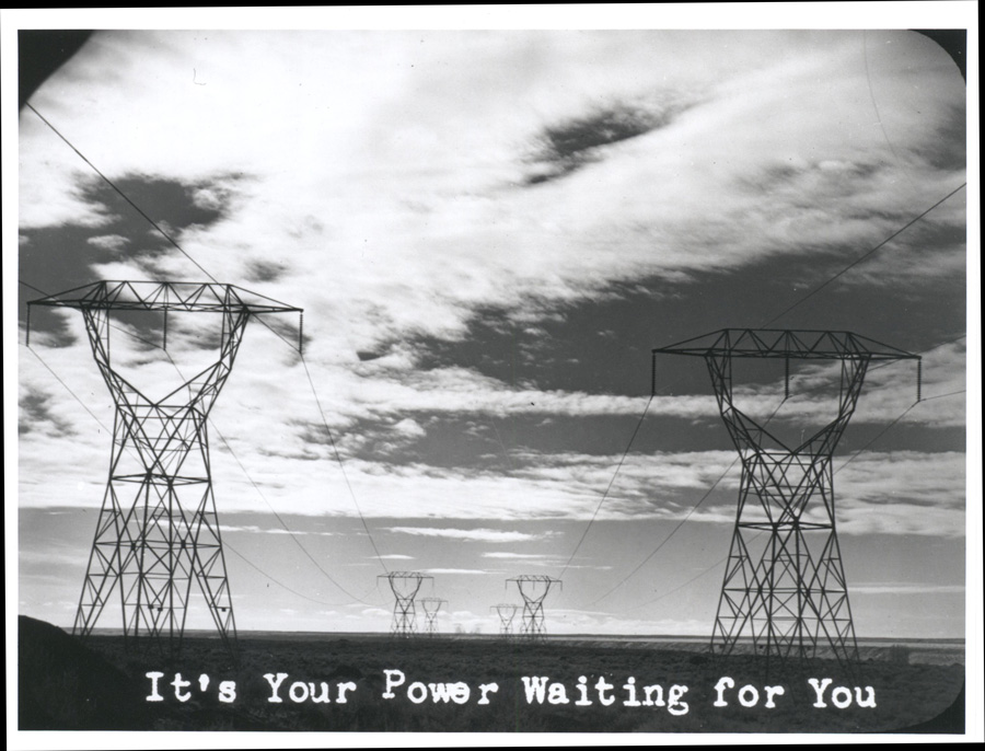 Glass Slides, 1941-1960; Portland Regional Office; Records of the Bonneville Power Administration (RG 305) Glass Slides, 1941-1960; Portland Regional Office; Records of the Bonneville Power Administration (RG 305) | The Bonneville Power Administration (BPA) was created in 1937 to market and deliver to homes and businesses the hydroelectric power generated by Bonneville Dam and, later, Grand Coulee Dam. Currently, BPA has more than 15,000 miles of electrical lines, such as those shown in this image, and 300 substations in the Pacific Northwest. It controls approximately 75 percent of the transmission lines in the region. As of 2006, BPA still provides about half the electricity used in the region. This image was reproduced from a glass slide. (ca. 1946) |
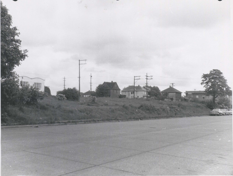 Photo taken of the future site of the Seattle WorldÂ’s Fair prior to demolition of existing structure and the construction of the fairgrounds. Photo taken of the future site of the Seattle WorldÂ’s Fair prior to demolition of existing structure and the construction of the fairgrounds. 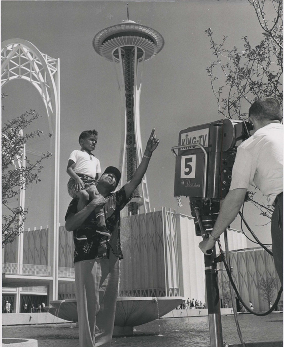 With his son on his shoulders, a father is interviewed by KING-TV in front of the Space Needle. (1962) With his son on his shoulders, a father is interviewed by KING-TV in front of the Space Needle. (1962) | 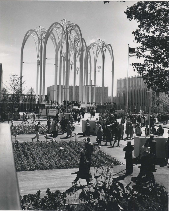 Crowds enjoy the Seattle WorldÂ’s Fair in front of the U.S. Science Pavilion (now the Pacific Science Center) and the landmark arches designed by local architect Minoru Yamasaki. Yamasaki later designed the Twin Towers in New York City. (1962) Crowds enjoy the Seattle WorldÂ’s Fair in front of the U.S. Science Pavilion (now the Pacific Science Center) and the landmark arches designed by local architect Minoru Yamasaki. Yamasaki later designed the Twin Towers in New York City. (1962) |
Conceived to commemorate the golden anniversary of the Alaska-Yukon-Pacific Exposition, held in 1909 on the University of Washington campus, the Century 21 World's Fair opened in April 1962. The theme of the Seattle World's Fair was a consideration of the possibilities of life in the twenty-first century. |
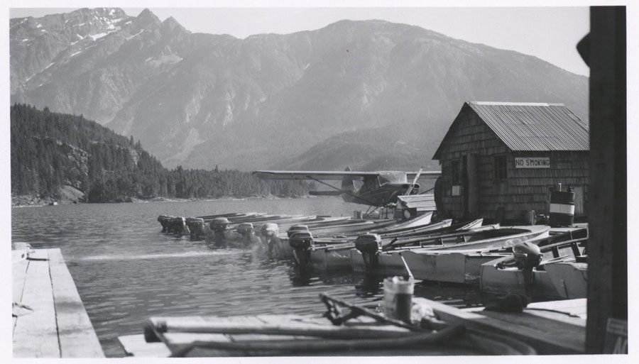 Historic Photos, 1914-1960; Region 6, Portland, Oregon; Records of the Forest Service (RG 95) Historic Photos, 1914-1960; Region 6, Portland, Oregon; Records of the Forest Service (RG 95) | A float plane rests on the lake at Ross Lake Resort, North Cascades National Park. The lake was created by the damming of the Skagit River. The resort consists of a line of individual cabins and three bunkhouses built on log floats accessible only by boat or float plane. The resort is still open. (August 1955) |
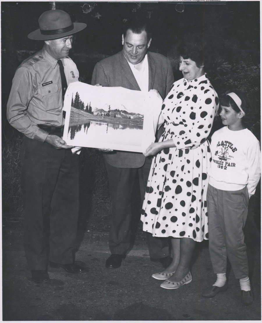 Park Central Files, 1884-1993; Mount Rainier National Park; Records of the National Park Service (RG 79) Park Central Files, 1884-1993; Mount Rainier National Park; Records of the National Park Service (RG 79) | With her husband and daughter looking on, Mt. Rainier National Park Superintendent John Rutter presents a picture to Gwendaline Jones as her memento for being the billionth visitor to the National Park System, a good indication of how much the American public took to the road to travel in the post-war years. Clearly the Joneses have been touring the Pacific Northwest in the summer of 1962 - note Petula's sweatshirt from the 1962 Seattle World Fair. |
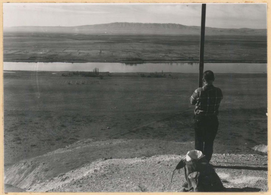 Survey Report Files, ca. 1900-1972; Seattle District Office; Records of the Office of the Chief of Engineers (RG 77) Survey Report Files, ca. 1900-1972; Seattle District Office; Records of the Office of the Chief of Engineers (RG 77) | Throughout the last half of the 1960s, the U.S. Army Corps of Engineers continued to look for ways to tap the hydroelectric potential of the Columbia River and to create reservoirs to provide irrigation to farmers in Eastern Washington. In this image, a Corps employee is surveying the site of the proposed Ben Franklin Dam. This dam was never built. (ca. 1965) |
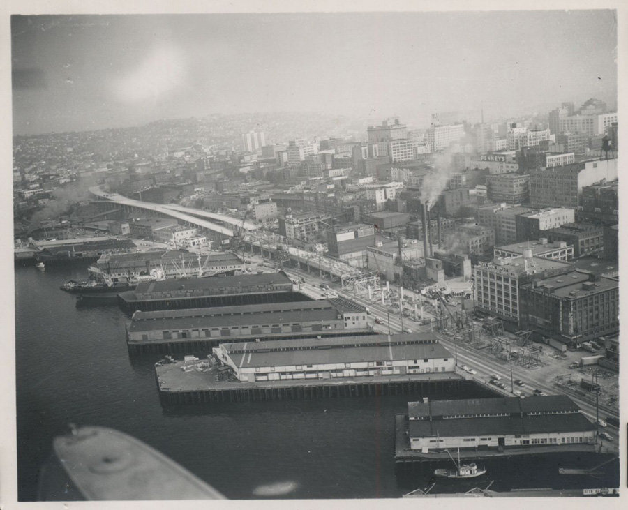 Alaska Way Project File; Federal Aid Project Files, 1919-1968; Olympia State Office; Bureau of Public Roads (RG 30) Alaska Way Project File; Federal Aid Project Files, 1919-1968; Olympia State Office; Bureau of Public Roads (RG 30) | In an effort to allow for the continuous flow of traffic along Highway 99, the Alaskan Way Viaduct was opened in 1953. At that time it was the main artery for automobile traffic through Seattle and followed the former route of defunct railroad lines that once ran along the Seattle waterfront. This image shows the partially completed viaduct just as it starts the northern end of the double decked portion. |
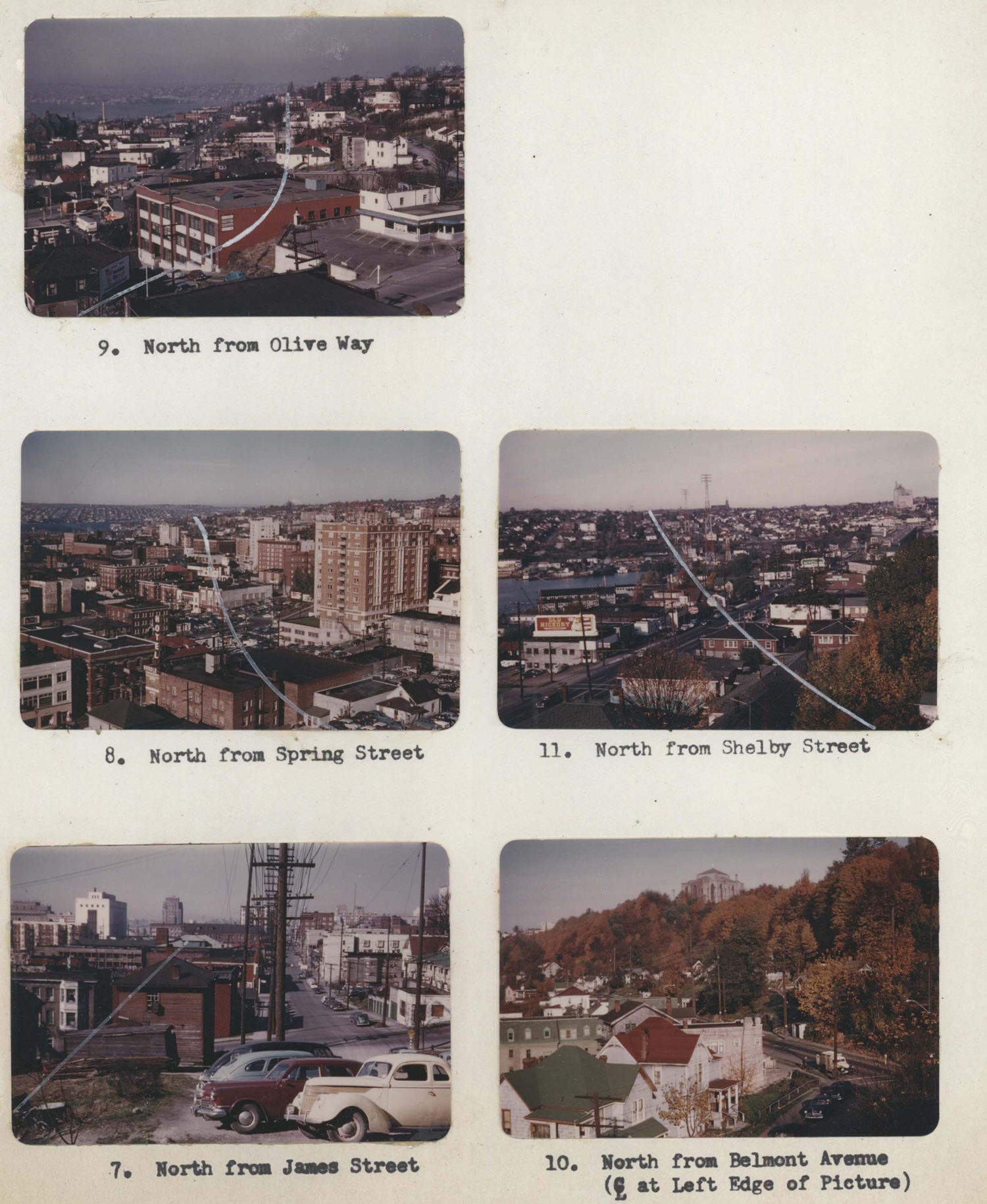 Seattle Freeway Federal Aid Project File, 1967-68; Olympia State Office; Bureau of Public Roads (RG 30) Seattle Freeway Federal Aid Project File, 1967-68; Olympia State Office; Bureau of Public Roads (RG 30) |
The National System of Interstate and Defense Highways Act was signed into law in June 1956. This law was the culmination of decades of effort to legislate the development and maintenance of roads. The state of Washington swiftly moved to establish funding for a construction plan for the Seattle Freeway. It was later incorporated into Interstate 5, which would eventually run along the entire west coast of the United States from Canada to Mexico. The route through Seattle fell on a pre-existing plan for a toll road which had been routed through higher population areas in hopes of producing strong toll revenues. These photographs show the proposed routes through Seattle neighborhoods. Approximately 4,500 parcels of land along the urban route were fated for removal. Owners were guaranteed fair market value for their property. Lands not purchased in agreement with the state Highway Department were obtained through condemnation. The Freeway opened to traffic in December 1962. |