Aerial Photography at the National Archives at Seattle, Washington
Contact Information for NARA at Seattle
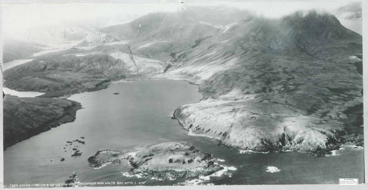
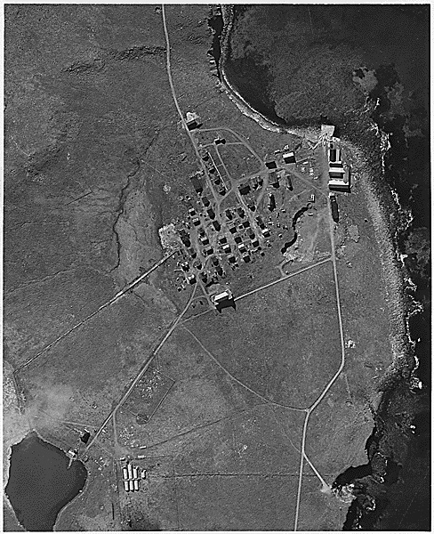
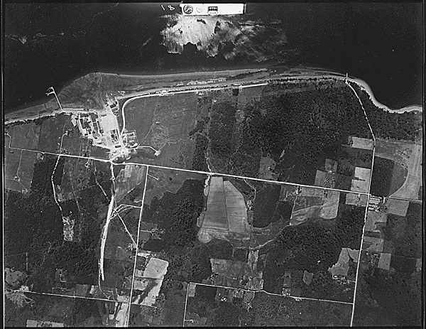
Record Group 18: Aerial Photographs of Attu Island, 9/18/1942 - 9/28/1942
This series consists of aerial reconnaissance photographs of Attu Island, off the coast of Alaska. Locations include Chichagof Harbor, Holtz Bay, Sarana Bay, Alexai Point, and Kennon Island. The finding aid for the series is available at NARA at Seattle. This series is partially digitized.
Record Group 22: Pribilof Islands Photographs, ca. 1890 - ca. 1970
This series documents the fur seal harvest; the procedures and processes of the fur seal industry; religious, educational, and social events; and the physical geography of St. Paul and St. George Islands. It is unprocessed but open to the public. This series is partially digitized.
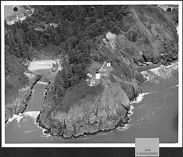
Record Group 26: Photographs of Aids to Navigation, 1942 - 1958
This series consists of photographs of aids to navigation in Oregon and Washington. A few aerial photographs of locations in Alaska are included. The section of major aids to navigation includes photographs of light, radio, loran and lifeboat stations; lighthouses; and lightships. The section of minor aids to navigation includes photographs of buoys or other floating aids; pier or jetty lights; day beacons; private lights; channel lights; fog signals; and range lights. Additional photographs document the work done by Coast Guard tenders in support of aids to navigation. Most photographs have associated data sheets that list the subject, date taken and additional remarks. A few data sheets are present without associated photographs. The finding aid for the series is available at NARA at Seattle. This series is partially digitized.
Record Group 49: Aerial Forest Inventory Photographs, 1958 - 1965
This series consists of aerial photographs of land areas in Northern Idaho for a forest inventory. Included are maps with flight line information. The finding aid for the series is available at NARA at Seattle.
Record Group 49: Aerial Photographs, 1939 - 1962
This series consists of aerial photographs of land areas in southwest Oregon along the border with California. The finding aid for the series is available at NARA at Seattle.
Record Group 49: Aerial Photographs, 1940 - 1950
This series consists of aerial photographs of land areas in south central Idaho. The finding aid for the series is available at NARA at Seattle.
Record Group 49: Aerial Photographs, 1947 - 1979
This series consists of aerial photographs of land areas in west central Oregon. The finding aid for the series is available at NARA at Seattle.
Record Group 49: Aerial Photographs, 1949 - 1972
This series consists of aerial photographs of land areas in southwest Oregon. The finding aid for the series is available at NARA at Seattle.
Record Group 49: Aerial Photographs, 1954 - 1977
This series consists of aerial photographs of land areas in eastern Oregon. The finding aid for the series is available at NARA at Seattle.
Record Group 49: Aerial Photographs, 1956 - 1971
This series consists of aerial photographs covering the Shoshone District in south central Idaho. The finding aid for the series is available at NARA at Seattle.
Record Group 49: Aerial Photographs, 1964 - 1985
This series consists of aerial photographs of land areas in western Oregon. The finding aid for the series is available at NARA at Seattle.
Record Group 49: Aerial Photos, 1939 - 1952
This series consists of aerial photos of the Quartzville Creek and Thomas Creek areas. The finding aid for the series is available at NARA at Seattle.
Record Group 49: Group Files for Rectangular Surveys of the Public Domain, 1910 - 1969
This series consists of individual Group Files relating to the surveying of public domain land in Washington state. The files include instructions and amended special instructions, miscellaneous correspondence, bills for survey crews and costs involved with office work, diagrams, aerial photos, field notes, calculations, and information about how the specific group relates to other group surveys.
Record Group 49: Group Survey Case Files, 1923 - 1970
This series consists of case files for group surveys conducted in Idaho. Records within each file vary but may include correspondence, plat maps, special instructions, and survey field notes. A small number of files also contain aerial photographs.
Record Group 49: Resources Inventory, Study, Survey and Mapping Files, 1945 - 1990
This series consists of maps, survey notes, timber stand examinations and inventories, studies, and aerial photographs related to planning units under the control of the Pocatello Field Office. Information includes legal descriptions of the land, the acreage involved, land features, the condition of stands of timber in the planning unit, notes on wildlife present, management actions taken, minerals present, and when and by whom the unit was inspected. The finding aid for the series is available at NARA at Seattle.
Record Group 49: Townsite Trustee Files, ca. 1905 - 1995
This series consists of records related to the survey of Alaska native townsites and the legal transfer of land within townsites. Files may contain maps, surveys, aerial photographs, deed applications, deeds, correspondence, accounting information, petitions for townsites and tract book pages. The finding aid for the series is available at NARA at Seattle.
Record Group 57: Aerial Photographs, 1966 - 1974
This series consists of aerial photographs taken of the following rivers and creeks in Washington State: American, Cedar, Chewack, Chiwawa, Cloquallum, Elochoman, Humptulips, Kalama, Methow, Nason, Nooksack (north fork), Satsop (middle fork), Snohomish, Snoqualmie, Stillaguamish (north fork), Wind and Wynoochee. The finding aid for the series is available at NARA at Seattle.
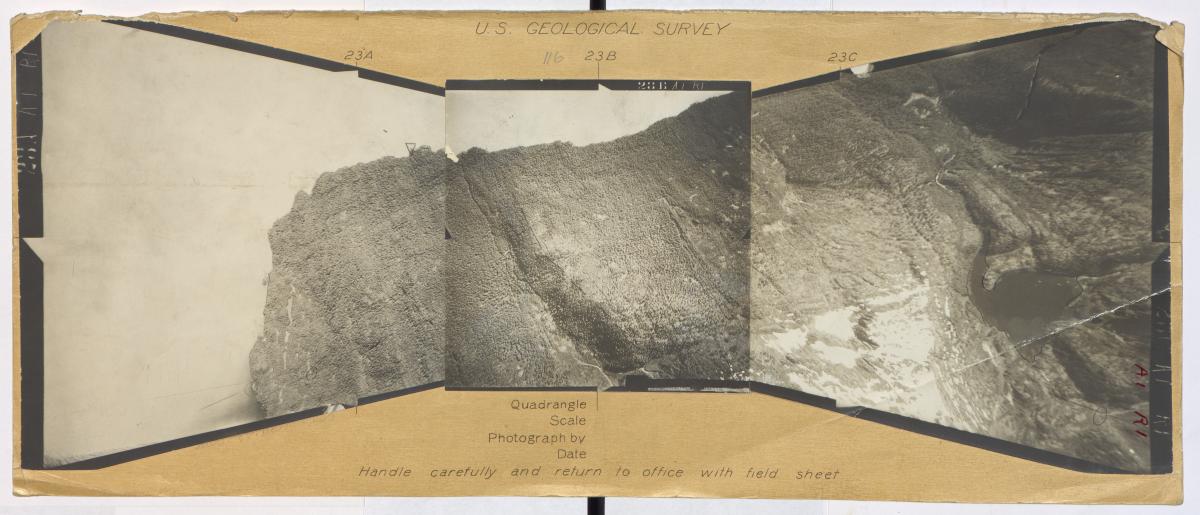
Record Group 57: Alaskan Aerial Survey Expedition Photographs, 1926 - 1929
This series consists of approximately 17,280 tri-lens black and white aerial photographs of 10,000 square miles of southeast Alaska. Islands included in the aerial survey are Admiralty, Annette, Baranof, Chichagof, Gravina, Prince of Wales, and Wrangell. Also included are photographs of Glacier and Lituya Bays; Duncan Canal; and the Coast Mountains south from Haines to Ketchikan. The villages, towns, and cities shown on the aerial photographs include Craig, Douglas, Hydaburg, Juneau, Kake, Kasaan, Ketchikan, Metlakatla, Petersburg, Sulzer, Tyee and Wrangell. These surveys were taken using U.S. Navy personnel, airplanes, and equipment in cooperation with the Geological Survey. The records were maintained by the U.S. Geological Survey in Washington, DC, and copies were placed with the U.S. Forest Service and other interested government agencies. The finding aid for the series is available at NARA at Seattle. This series is partially digitized.
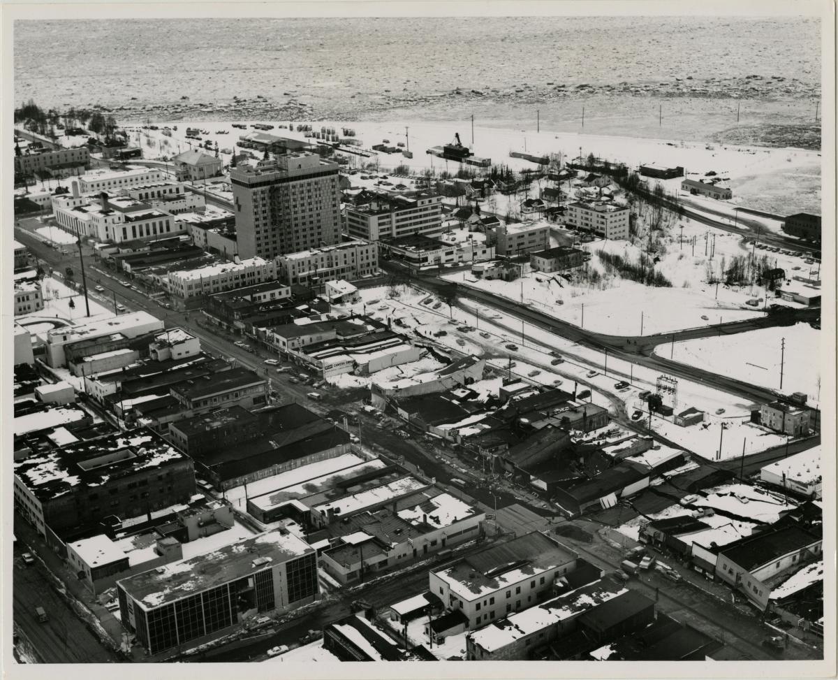
Record Group 75: 1964 Alaska Earthquake Photographs, 1964 - 1965
This series consists of black and white photographs taken by the Alaska District of the U.S. Army Corps of Engineers of the damage done by the 1964 Good Friday Alaska earthquake and the subsequent recovery efforts. The areas represented are Anchorage, the Turnagain Arm residential area, Denali Elementary School, Cordova, Elmendorf Air Force Base, Fort Richardson, Girdwood, Homer, Kodiak, Moose Pass, Nikolski, Seldovia, Seward, Tatitlek, Valdez, and Whittier. This series is partially digitized.
Record Group 75: Aerial Photographs of Forest Land, 1949 - 1950
This series consists of photographs of forest land on and near the Umatilla Reservation. A date and alphanumeric designator appears at the top of each photograph. Most are annotated on the back with the township, range, and section, and are stamped "USDA" (U.S. Department of Agriculture).
Record Group 75: Aerial Photographs of the Klamath Indian Reservation, 1952 - 1959
Sequential series of aerial photographs have some boundaries of natural resource areas marked in red. Some survey corners and landmarks are annotated in red. The photographs are numbered sequentially down the flight line.
Record Group 75: Aerial Photographs of Klamath Indian Reservation Timber Units, 1956
This series consists of aerial photographs of the Klamath Indian Agency's Chiloquin, Klamath Marsh, and Sprague River timber units.
Record Group 75: Celilo Village Relocation Records, 1947 - 1964
This series consists of correspondence of the Branch of Property and Supply relating to the relocation of Celilo Village after the completion of the Dalles Dam inundated Celilo Falls (1954 - 1958); and the relocation of Yakima graves flooded by McNary Dam (1948 - 1952). The series also includes the files of Edward Swindell regarding Celilo Village matters, work orders for housing, a Celilo Village census record (1956), and Celilo Village photographs (undated - 1952). There is also a report on the sanitary conditions at Celilo Village (1940).
Record Group 75: Mission Correspondence, 1935 - 1968
This series consists of correspondence, photographs, reports, and administrative materials including vouchers, permits, payrolls, and personnel records. There are aerial photographs of villages along the coast of Alaska taken by Bureau of Indian Affairs' personnel aboard the supply ship, North Star III. There are also photographs of towns, buildings, and ship personnel. The finding aid for the series is available at NARA at Seattle.
Record Group 75: Soil and Moisture Conservation Program Subject Files, 1952 - 1956
This series contains annual Soil and Moisture Conservation (SMC) Program reports, newsletters; allottees' farm plans arranged by name of farmer and including applications for assistance; conservation programs, land use maps, and aerial photographs; and SMC decimal correspondence files and activity records.
Record Group 77: Civil Works Project Aerial Photographs, 1948 - 1959
This series consists of aerial photographs taken by the district office staff. The series includes images of flood damage and aerial views of the sites of flood control projects, dams, and other civil works projects. The majority of the photographs were taken above the Columbia, Salmon, Snake, Teton, Gros Ventre, Boise, John Day, Grande Ronde, Walla Walla, Palouse, Imnaha, and Portneuf Rivers. The finding aid for the series is available at NARA at Seattle.
Record Group 77: Comprehensive Reports and Studies, 1941 - 1945
This series consists of aerial photographs, maps, designs, plans, and reports related to the study of the feasibility of a proposed Trans Canadian, Alaskan and Western Railway, specifically a line running from Prince George, British Columbia to Teller, Alaska at Port Clarence on the Seward Peninsula. The study also examined the possibility of a harbor at Port Clarence and a pipeline to run from Tanana, Alaska to Teller. The finding aid for the series is available at NARA at Seattle.
Record Group 77: Historic Photographs, ca. 1891 - 1982
This series consists of photographs documenting various projects undertaken by the Portland District Office of the U.S. Army Corps of Engineers. Some of the significant projects and subjects depicted include Bonneville Lock and Dam, Celilo Falls, the Dalles-Celilo Lock and Dam, John Day Dam and Oregon City Locks. Rivers depicted include the Cowlitz, Columbia, Snake, Toutle, Umpqua, Willamette and Deschutes. Also included are images of the Mount St. Helens area after the volcano erupted. The finding aid for the series is available at NARA at Seattle. This series is partially digitized.
Record Group 77: Investigational Project Files, 1948 - 1994
This series consists of calculation files; correspondence; topographic and hydrographic maps; isohyetal maps; drainage maps; land use maps; computer printouts; river and lake ice research and design papers; sedimentation studies; storm studies; floodplain information; and aerial photographs and photo mosaics for various waterways and projects in the Walla Walla District. Documents in these files relate to investigations of one or more of the following subjects: hydraulics, hydrology, structural design, electrical and mechanical design, geology, soils, concrete, pavements, bituminous materials and materials for building construction. Files primarily involve dams and dam sites, reservoirs, flood control planning and fish hatcheries built on the Snake River under the Lower Snake River Compensation Plan (LSRCP; also referred to as the Lower Snake River Fish and Wildlife Compensation Plan (LSRFWCP)). The finding aid for the series is available at NARA at Seattle.
Record Group 77: Navigable Waterways Files, 1922 - 1971
This series consists of records maintained by the Alaska District of the Army Corps of Engineers documenting various projects and programs related to navigable waterways in Alaska. There is a location map and an as-built drawing for the Baranof Sea Plane Facility; a booklet, "Oil and Refuse Pollution, Alaska (1965)," compiled by the U.S. Army Engineer District, Alaska; and surveys, reports, and correspondence related to harbors and harbor facilities. There is also correspondence and other material on the construction of tramways and waterways on the portage between the Yukon and Kuskokwim Rivers (1922-1938) in cooperation with the Alaska Road Commission. Included is a 1910 narrative of the reconnaissance trip of the Acting Superintendent of the Alaska Road Commission through the Kuskokwim and Iditarod country and a 1971 report from the Division Engineer, North Pacific, on the same area (with aerial and other photographs). The finding aid for the series is available at NARA at Seattle.
Record Group 77: Survey Report Files, ca. 1910 - ca. 1972
This series contains planning reports, photographs (including aerial photographs), topographic maps, watershed maps, preliminary specifications, technical drawings, and other records relating to civil engineering works projects. Also included is correspondence from members of Congress and officials in state and local governments relating to the impact of or need for projects within their jurisdictions. Newspaper clippings about proposed projects provide insight into the community attitude toward the projects. Businessmen, civic organizations, professional organizations and private citizens also corresponded with the Seattle District and submitted petitions relating to civil works projects. The files also contain information from public hearings, such as hearing notices, transcripts and exhibits. The finding aid for the series is available at NARA at Seattle.
Record Group 79: Alaska Task Force Photographs, 1972 - 1976
This series consists of photographs documenting national parks in Alaska. Subjects include flora, fauna, facilities, rivers, mountains, other natural features, towns and villages, and activities of park personnel and visitors. The finding aid for the series is available at NARA at Seattle. This series is partially digitized.
Record Group 79: Subject Files, 1952 - 1978
This series consists of studies, reports, publications, plans, recommendations, environmental impact statements, meeting minutes, correspondence, photographs, maps, and memoranda related to work done by the National Park Service in Alaska. Records in this series relate to the study of cultural resources, oil and gas potential, minerals and mining resources, subsistence use, historic preservation and other subjects. Records in this series also include weekly, monthly, quarterly, trip, and situation reports, as well as recommendations, selections, hearings, and reports related to the Alaska Native Claims Settlement Act (ANCSA). There are also newspaper clippings, aerial photographs, and maps relating to land use; and committee meeting minutes relating to coordination with the Alaska Visitor's Association and federal and state agencies. This series also has published and non-published papers on subjects of interest to National Park Service personnel and the public. The finding aid for the series is available at NARA at Seattle.
Record Group 95: Aerial Photographs, 1928 - 1956
This series consists of aerial photos taken of various parts of the Mt. Baker and Snoqualmie National Forests. Some flight lines have maps and indexes that can be used with the photos. There are a few photos showing logging operations, rivers and rights of way. The finding aid for the series is available at NARA at Seattle.
Record Group 95: Forest Supervisors' Alphabetical Files , 1907 - 1965
This series consists of correspondence, maps, plans, reports, statistics, studies and surveys relating to land use in the Siskiyou National Forest. The records include inspections of forest activities; improvements to buildings, roads and trails, and other forest infrastructure; fire control including cooperation between the state and local counties, aerial photographs and fire atlas; forest boundaries and forest operations in the Siskiyou National Forest. The finding aid for the series is available at NARA at Seattle.
Record Group 95: Historical Photograph Files, 1906 - 1994
This series consists of photographs taken or collected by Forest Service personnel throughout Alaska. The subjects covered in these photographs include forest views; logging operations; lakes and rivers; glaciers; Alaskan villages; trails and camps; personnel; roadhouses; Healy River coal fields; homesteads and gardens; recreation sites; wildlife including seals, bears, and moose; and commercial fishing and Forest Service boats. There are photographs of Valdez harbor and the surrounding area affected by the spilling of oil from the Exxon Valdez (tanker ship) when it ran aground on Bligh Reef near Valdez, Alaska. The photographs document the oil pollution of beaches, water, animals, and birds. The photographs include the wildlife receiving station (morgue) in Valdez; Forest Service and other personnel assessing damage and assisting in the clean-up; animals, fish, and other sea-life affected by the oil spill; aerial and ground views of the Smith Island clean-up effort; general views of contaminated beaches; the Alyeska Terminal at Valdez; otter rescue activities and the otter rehabilitation center; the bird rescue center; views of oil skimmers at work on the beaches; aerial and other views of the Exxon Valdez oil tanker; and the Valdez harbor area. There are also color photographs of the Kennecott Mine and foreign forestry practices from Japan and China.
Record Group 95: Records Related to Wild and Scenic Rivers, 1969 - 1979
This series consists of correspondence, guides, maps, photographs, plans, and proposals relating to wild and scenic rivers in the Bitterroot National Forest. Included are aerial photographs, a multi-use planning guide, management plans, acquisition plans and proposed cooperative agreements.
Record Group 129: Photographs, 1890 - ca. 1970
This series includes photographic prints, graphic prints, aerial photographs, scrapbooks and albums of photographs of McNeil Island Penitentiary and McNeil Island in general. The images depict the physical layout of the prison and specialized buildings, construction and demolition projects, construction of staff housing, prison boats, inmate farming operations, inmate activities, prison conditions, road building, ship building, and construction and alteration of the penitentiary over time. Also included are early photographs of wardens, guards, staff and a few visiting dignitaries. Dignitaries include Babe Ruth and the Harlem Globetrotters. African-American inmates appear in a few images. This series is partially digitized.
Record Group 181: Administrative Files, 1944 - 1946
This series consists of fleet letters, notices, bulletins, memorandums, maps, correspondence, reports, and inventories created or maintained by the 17th Naval District Commandant during and after World War II. There are photographs of low approach group patrol bomber sqandrons' flight equipment, landing fields and landing field lights. There are also aerial photographs of the Naval Air Stations on Adak and Tanaga (1944). Included are flight reports and maps; correspondence on coastal surveys; and the decommissioning of radar beacons in Alaska. The finding aid for the series is available at NARA at Seattle.
Record Group 181: Administrative Files, 1948 - 1959
This series consists of correspondence, orders, regulations, reports, photographs, and maps related to the exploration, discovery, and drilling for oil and gas in Naval Petroleum Reserve Number 4 in Alaska. There are maintenance reports for Long Range Navigation Station, Beetle Able. There is also an aerial photograph of Barter Island with an index map (1943).
Record Group 181: Central Subject Files, 1943 - 1945
This series consists of correspondence, memorandums, speedletters, orders, reports, inventories, logbooks, war diaries, personnel rosters, copies of regulations, and other administrative material related to the plans, policies, and procedures used in operating the Auxiliary Air Facility, Shemya, Alaska. The station served as a support base and auxiliary landing field for the Naval Air Station on Attu Island, Alaska, during World War II. There are maps and aerial photographs of Shemya. The finding aid for the series is available at NARA at Seattle.
Record Group 181: Central Subject Files, 1943 - 1947
This series consists of memorandums; weekly, monthly and annual reports; war diaries; orders; plans; bulletins; and other administrative material maintained by the Naval Air Facility at Adak, Alaska during and after World War II. There are maps, charts, aerial and other photographs. The finding aid for the series is available at NARA at Seattle.
Record Group 181: Historical Files, ca. 1900 - ca. 1994
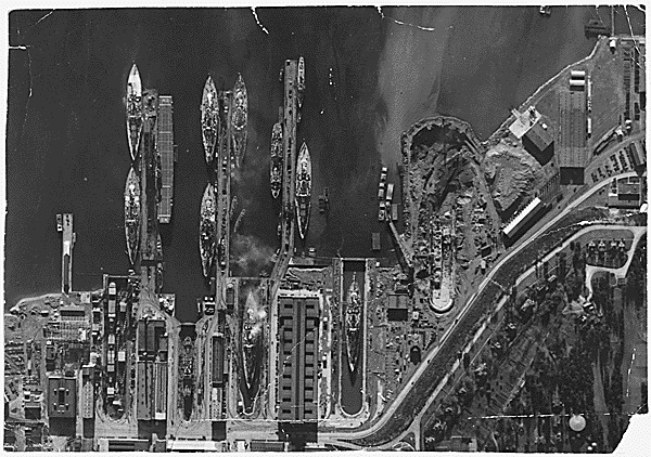
This series consists primarily of photographs although there is some textual material as well. The photographs show the building of the first three dry docks at the Puget Sound Navy Yard (now Puget Sound Naval Shipyard) at the turn of the century. Additional photographs document the construction of other buildings at the Yard including some World War II and later construction. In 1993-1994 a team from Historic American Buildings Survey/Historic American Engineering Record surveyed buildings at Puget Sound Naval Shipyard for possible inclusion in the National Trust for Historic Preservation. Photographs and reports from that survey are included in this collection. Also included are uncorrected briefings and exhibits for the proposed dry dock 6 to be presented to possible contractors (dry dock 6 was dedicated in 1962) and organization charts from 1946-1951. The finding aid for the series is available at NARA at Seattle. This series is partially digitized.
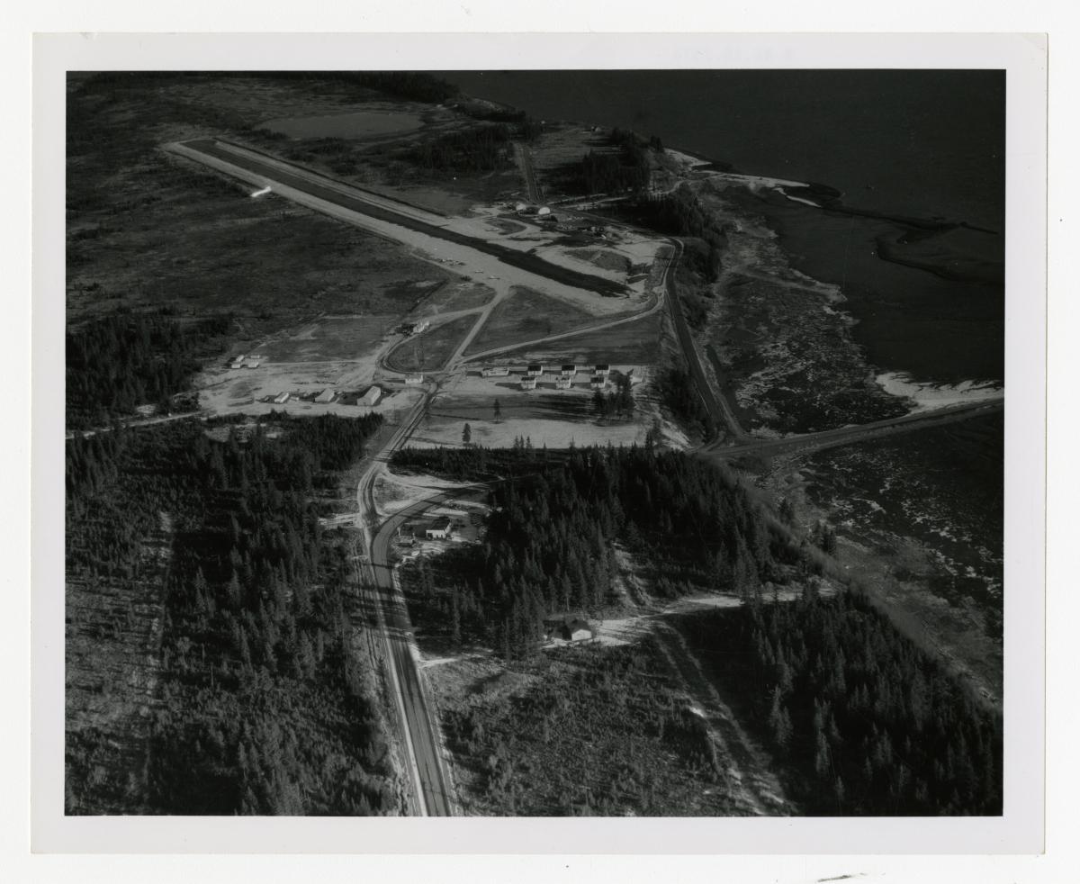
Record Group 237: Photographs Relating to Federal Aviation Facilities, 1946 - 1972
This series consists of photographs relating to the Federal Aviation Administration's area operations and facilities throughout Alaska. These locations and facilities include the Aleskya Oil Pipeline, Mt. McKinley or Denali, Merrill Field, Elmendorf Air Force Base, Akiak, Amchitka, Cordova, Fairbanks, Iliamna, Kodiak, Metlakatla, Nenana, Nome, Portage, Skagway, Juneau, Tanana, and Wrangel. The finding aid for the series is available at NARA at Seattle. This series is partially digitized.
Record Group 336: Organizational History Files, 1943 - 1955
This series consists of records relating to the history of the Seattle Port of Embarkation. Contents include photographs, including aerial photographs of locations in Washington and Alaska; articles; histories; newspaper clippings; reports; correspondence; and materials relating to employee achievements and special events.
Record Group 342: Photographs, 1941
This series consists of photographs, including many aerial images. Subjects include the federal building in Anchorage, Cape Puget, Chisiki Island, the Chugach Mountains, Excelsior Glacier, Redoubt Mountain, the Iliamna Volcano, Kenai Mountain, the Matanuska Valley, Seward and the troop ship, U.S.A.T. St Mihiel.
Record Group 370: Project Case File Photographs, 1948 - 1976
This series consists of slides from Auke Bay Fisheries Laboratory project case files. The range of project numbers is A4044 to A4123. Images were taken primarily around Prince William Sound and consist of aerial photos and photos of buildings, animals, spawning channels, traps, boats, and activities performed by the Auke Bay Laboratories employees. The finding aid for the series is available at NARA at Seattle.
Record Group 385: Aerial Photographs of Adak Island, Alaska, 7/11/2001 - 7/18/2001
This series consists of aerial photographs of Adak Island, Alaska. The finding aid for the series is available at NARA at Seattle.
Record Group 406: Project Case Files, 1919 - 1969
This series consists of project case files relating to the building and maintenance of roads, trails, bridges and ferries throughout the Territory of Alaska. They contain contract and bid forms; inspection, weekly, monthly and final reports; financial and administrative correspondence; and memorandums. Included in this series are the federal aid project case files regarding projects in the State of Alaska. They contain project agreements, certificates of approval, specifications, cost estimate reports, project statements, construction inspection and final reports, and vouchers pertaining to funding. There are some charts, maps, and photographs. The finding aid for the series is available at NARA at Seattle.
Record Group 552: Organizational History Files, 1/1/1946 - 12/31/1982
This series consists of records relating to the history of the Pacific Northwest Outport. Contents include photographs, including aerial photographs of locations in Washington and Alaska; articles; histories; newspaper clippings; reports; correspondence; and materials relating to employee achievements and special events.
