![]()
Record Group 49: Records of the Bureau of Land Management
The National Archives and Records Administration (NARA) houses historical records of the Bureau of Land Management (BLM) and its predecessor, the General Land Office (GLO), in Record Group 49. These records include correspondence, allotment schedules, patent files, maps, and other materials related to American Indians and Alaska Natives.
Agency Overview
The BLM administers over 245 million acres of public land, largely in the western United States. The agency was established in the Department of the Interior in 1946 with the merger of the GLO and the Grazing Service.
The GLO was established in 1812 (2 Stat. 716). The agency was responsible for the disposition of public land. This included surveying public lands, and issuing and recording land patents. The Grazing Service was established in 1939 to manage grazing leases on public lands.
Until the Bureau of Indian Affairs (BIA) was given statutory authority in 1832 (4 Stat. 564), the GLO was responsible for administering Indian reserves as laid out in treaty provisions. In 1837, the GLO transferred the majority of records related to Indian reserves to the BIA.
Even after the 1830s, however, the GLO worked closely with the BIA to survey and classify land, issue patents, and provide lands in the public domain for use by American Indian nations.
Records Overview
Microfilm
Some 19th-century records of the GLO/BLM are available as microfilm. These records can include correspondence related to American Indians. Select microfilm publications are listed below.
To browse additional microfilm publications and determine which National Archives research facility houses a copy, search the National Archives microfilm catalog. To order copies of microfilm rolls, see How to Order Digitized Microfilm.
-
NARA Microfilm Publication M25, Miscellaneous Letters Sent by the General Land Office, 1796–1889
-
NARA Microfilm Publication M477, Letters Sent by the Surveyor General of the Territory Northwest of the Ohio River, 1797–1854
- NARA Microfilm Publication M1288, Correspondence Received by the Surveyors General of New Mexico, 1854–1907
- This microfilm is digitized in the National Archives Catalog (National Archives Identifier 193007114).
- NARA Microfilm Publication P2013, Washington Territory Survey Correspondence, 1854–1895, Relating to Donation Land Claims and Indian, Lighthouse, and Military Reservations
Textual Records
Textual records of the GLO/BLM are housed at different National Archives research facilities, depending on the location of the GLO/BLM office.
Select series related to American Indians and Alaska Natives are listed below. For the full archival records descriptions in the National Archives Catalog, please select the National Archives Identifiers provided.
For questions related to these series, please contact the research facility where the records are housed.
GLO/BLM Headquarters Records
Contact the National Archives in Washington, DC, with questions about these records.
-
“Indian Reserve Files, ca. 1859–1927” (National Archives Identifier 7585324)
-
“Records Relating to Indian Reservations, ca. 1868–1964” (National Archives Identifier 5686439)
-
“Indian Fee Patent Files, 1902–1952” (National Archives Identifier 5686941)
GLO/BLM Field Office Records
- “Abstracts of Land Entries, 1834–1869” (National Archives Identifier 5757037)
- This series relates to Creek Nation reservations established under the Treaty of 1832. The records include individual surnames.
- Contact the National Archives at Atlanta with questions about these records.
- “Abstract of Chickasaw Reservations, 1837–1847” (National Archives Identifier 5889841)
- This series lists families on the Chickasaw Reservation as recorded under the Treaty of 1834.
- Contact the National Archives at Atlanta with questions about these records.
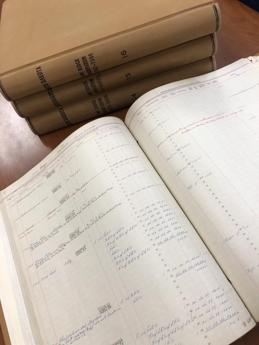
- “Indian Allotment Schedules, March 14, 1860–February 4, 1987” (National Archives Identifier 1756539)
- This series relates to the Santee, Ponca, Omaha, Iowa, Otoe, and Yankton tribes.
- Contact the National Archives at Kansas City with questions about these records.
- “Contest Case Files Relating to Native Alaskans Rights, ca. 1965–1972” (National Archives Identifier 4478008)
- This series is fully digitized in the National Archives Catalog.
- Contact the National Archives at Seattle with questions about these records.
To identify additional GLO/BLM textual records, search the National Archives Catalog by record group number (“49”), type of archival materials (“textual records”), and keywords (e.g., “Indian reservation,” “Seminole”). See Using the National Archives Catalog for additional search tips, and Contact Us with questions.
Cartographic Records
The Cartographic Branch at the National Archives at College Park, MD, houses many maps, plats, and other cartographic records created and maintained by the GLO/BLM, as well as some related textual records (e.g., field notes and reports on surveys). Select series related to American Indians and Alaska Natives are listed below.
- “Old Map File Manuscript and Annotated Maps of the United States and Its Territories, 1812–1946” (National Archives Identifier 305460)
- This series includes maps of American Indian reservations and land cessions.
-
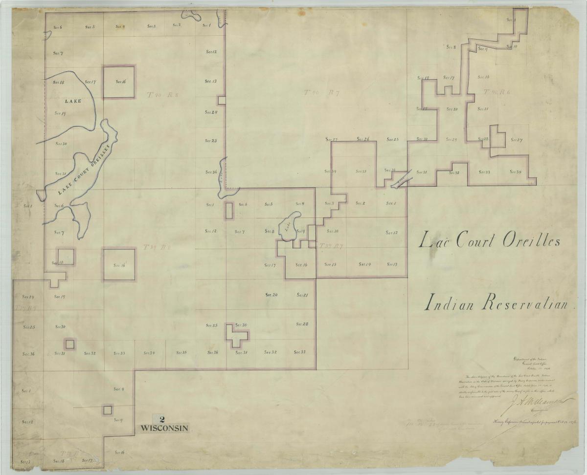
“Indian Reservation Plat Maps, ca. 1907–ca. 1930” (National Archives Identifier 624347)
- “Old Case 'F' File” Field Notes and Related Records, 1809–1938” (National Archives Identifier 305458)
- This series includes field notes pertaining to Indian land boundaries.
Special List No. 19, List of Cartographic Records of the General Land Office (Washington, DC: National Archives and Records Service, General Services Administration, 1964), describes many GLO maps in the Cartographic Branch’s holdings. This publication is also available online through the HathiTrust Digital Library.
However, other National Archives research facilities house select GLO/BLM cartographic records related to American Indians and Alaska Natives. For example, the National Archives at San Francisco houses the series, “Indian Reservation Survey Plats, ca. 1856–ca. 1930” (National Archives Identifier 5566757), which was maintained by the GLO’s Sacramento (California) Land Office.
To identify additional GLO/BLM cartographic records, search the National Archives Catalog by record group number (“49”), type of archival materials (“maps and charts”), and keywords (e.g., “Indian reservation,” “Seminole”). See Using the National Archives Catalog for additional search tips, and Contact Us with questions.