![]()
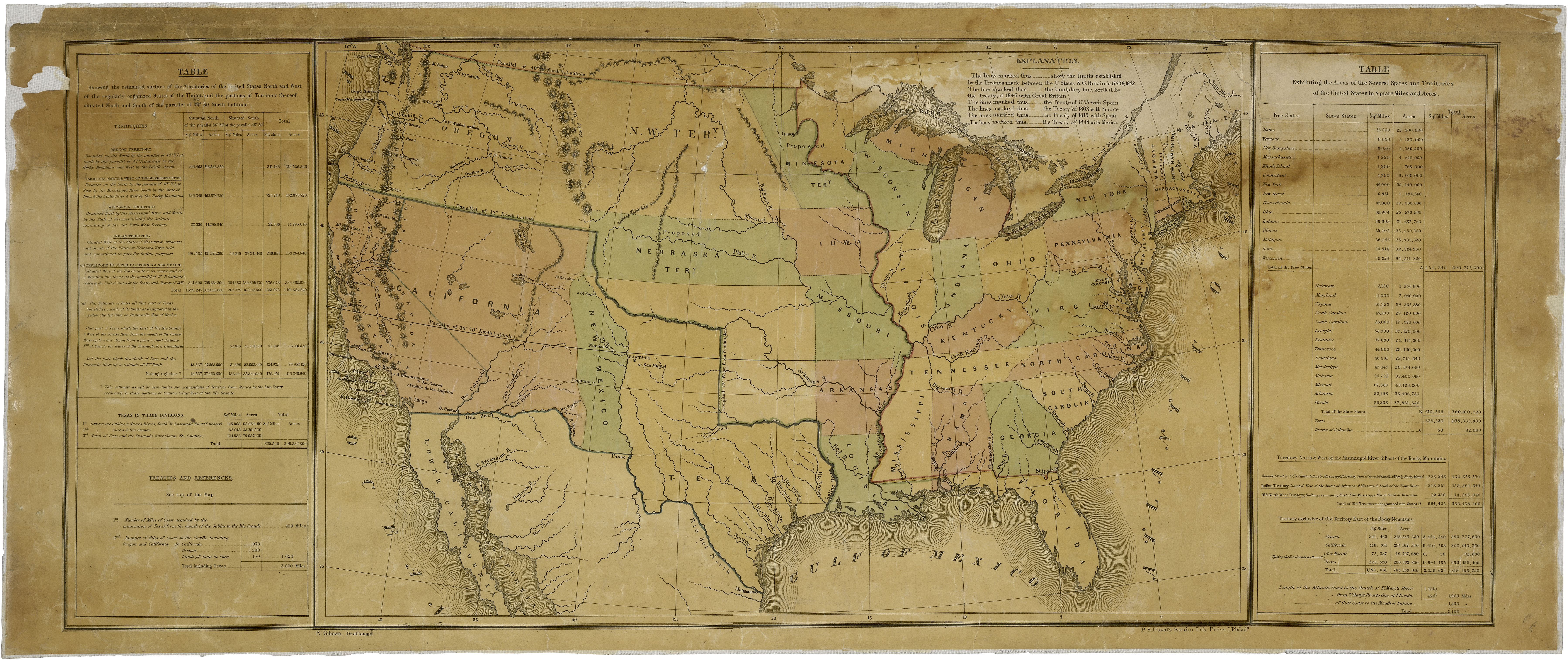
Map of the United States including Western Territories, December 1848
This map, which President James K. Polk sent to Congress with his annual message in 1848, shows the boundaries established by various treaties including the Treaty of Guadalupe Hidalgo which ended the Mexican-American War. The land the U.S. acquired as part of the treaty was eventually divided into ten states including parts of Arizona and New Mexico. The remainder of New Mexico and Arizona was acquired from Mexico under terms of the Gadsden Purchase Treaty in 1853.

Map of the United States including Western Territories, December 1848; Records of the U.S. House of Representatives. RG 233.