![]()
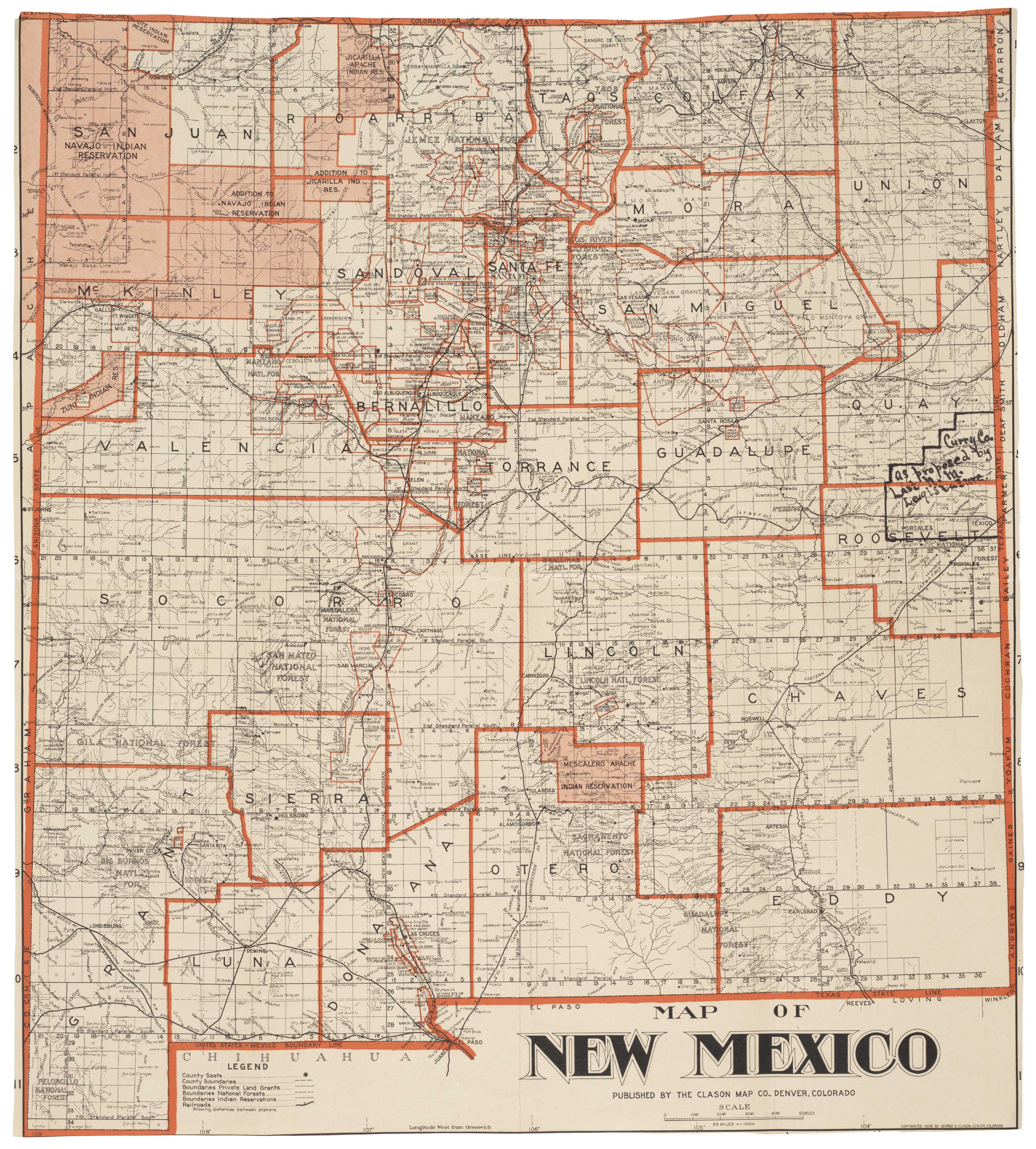
Map of New Mexico, showing county seats and boundaries, 1908
This map shows the New Mexico county boundaries as they existed in 1908 when the territory was seeking statehood. It also shows the proposed Curry County, named after then-Territorial Governor George Curry, which became a county in 1909.

Map of New Mexico, showing county seats and boundaries, 1908; Records of the U.S. House of Representatives, RG 233.