![]()
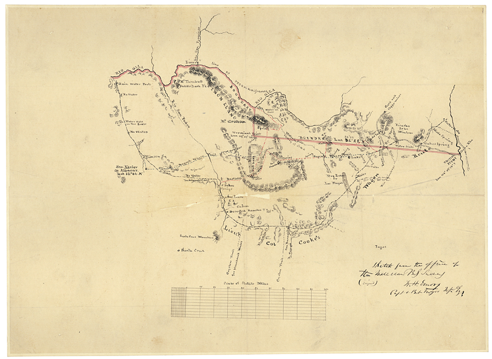
Sketch from the Office of the Mexican Boundary Survey, 1853
The Treaty of Guadalupe Hidalgo mandated that a boundary commission survey and mark the border between the U.S. and Mexico. The Army Corps of Topographical Engineers, under the direction of William H. Emory, conducted the actual surveying from 1848 – 1855. This sketch is from that survey. It shows the area south of the Gila River—part of present-day Arizona.
Sketch from the Office of the Mexican Boundary Survey, 1853; Records of the U.S. House of Representatives, RG 233