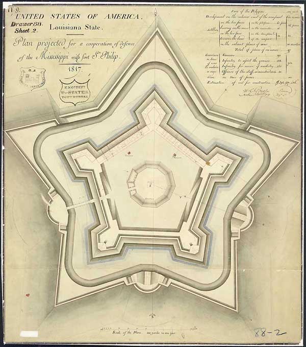
"Plan Projected for a Cooperation of Defense
of the Mississippi with Ft. St. Philip"
Drawn by cartographer and draftsman Guillaume Tell Poussin, 1817
Ink and wash on paper
23 1/4" x 20 1/4"
National Archives and Records Administration, Records of the Office
of the Chief of Engineers
Poussin's Fortifications: Fort St.
Philip
Bernard Simon, an expert in French fortification
planning, and Guillaume Tell Poussin, his cartographer and draftsman,
worked with the U.S. Army Corps of Engineers to design permanent plans
for protection of several American port cities. Here are two designs that
show that the basic star design had to be modified to accommodate actual
sites.
Fort St. Philip was part of the defense system designed to protect the approach to New Orleans, Louisiana. Here the basic five-pointed star design had to be modified to accommodate the marshy irregular site at Plaquemines Bend on the Mississippi River. Fort St. Philip was rebuilt several times during the 19th century.